
Buying land in Putnam County, FL: the complete buyer guide
Seven checks to make before you buy, in the order I’d make them, with the official sources linked.
Most people who call me about land in Putnam County have the same two questions underneath everything else. Will I be able to do what I’m planning on this lot? And is there something about it I don’t know yet?
Those are the right questions. A small lot near Interlachen or Satsuma can be a quiet place to fish and host family, a future spot for a manufactured home, or a parcel to hold for a few years before you build. But the price alone won’t tell you whether a lot will work. A short list of checks will, done in the right order with the offices that make the decisions.
This guide walks through those checks in the order I’d do them myself. I’ve linked straight to the county, state and federal pages so you can confirm everything yourself instead of taking my word (or any seller’s word) for it.
Quick summary: what to check before you buy in Putnam County
- Zoning. Is the parcel in a city or town, or in unincorporated Putnam County? What district is it in, and does that district allow your plan?
- Buildability. Has the county confirmed the lot can get a building permit? If you’re not sure, ask for a Lot Inquiry.
- Access. Does the lot have legal access, can you physically drive to it, and who maintains the road?
- Flood zone and wetlands. What do the FEMA and wetland maps show, and do you need a closer look?
- Well and septic. Who issues the permits, and is there room on the lot for both?
- Costs beyond the price. Annual taxes, special assessments and impact fees.
- Boundaries. Do you need a survey, or is the county map good enough for now?
Step 1: Check the zoning, and know what it does and doesn’t tell you
Before you look at the district, confirm who sets the rules. A parcel inside one of Putnam’s five cities and towns (Palatka, Crescent City, Interlachen, Welaka or Pomona Park) follows that town’s zoning, everything else follows unincorporated Putnam County’s rules, and a mailing address that says “Interlachen” doesn’t tell you which applies. To check, search the parcel on the Putnam County Property Appraiser site and open its “Land” tab, which the county’s Planning & Zoning page says shows the jurisdiction, the zoning district and the Future Land Use designation.
Zoning tells you which uses the county allows on a parcel and sets the basic dimensions a lot needs to meet. In Putnam County, three zoning districts come up most often for buyers looking at small residential lots or a manufactured home.
Where mobile homes are allowed. In its Planning & Zoning FAQ, the county lists three districts that allow mobile homes:
- Agriculture (AG)
- Residential-2 (R-2)
- Residential Mobile Home Park (RMH), which is meant for mobile home parks rather than single lots
R-1, for example, isn’t on that list.
What R-2 requires. R-2 is the zoning you’ll see most often on inexpensive lots around Interlachen. The county’s land development code (Table 7.02A, hosted on Municode) currently sets these R-2 standards:
- Minimum lot area: 7,500 square feet
- Minimum lot width: 75 feet
- Setbacks: 25 feet in front, 10 feet in the rear, 10 feet on each side, and 20 feet on the street side of a corner lot
- Maximum impervious surface: 50% of the lot
- Maximum building height: 35 feet
The same section of the code says other parts of the code and the comprehensive plan’s density limits can make the minimum lot area stricter, so treat these numbers as a starting point rather than a final answer. Municode itself notes that newly passed ordinances may not show up online right away.
Why zoning isn’t the whole story. An R-2 lot tells you that a home or a mobile home is an allowed use in that district. It doesn’t prove that your lot can get a permit. A lot might be smaller than the district minimum. It might have been split off without approval, or it might have access or environmental issues. Step 2 covers how to get a real answer.
A few other county rules worth knowing. According to the county’s FAQ, in residential zoning you need a building permit for the main home before you can put up a garage or storage shed. Boats, RVs and utility trailers stored on a residential lot have to sit beside or behind the home and meet the district’s setbacks. If you want to combine neighboring lots to have enough room to build, the county has a Combination Request process that goes through the Property Appraiser with written approval from Planning & Development.
Buying to hold? Will the zoning still be there in five or ten years? Nobody can promise that zoning won’t change. Counties amend their codes, and owners can apply to rezone. What you can do is record the zoning, the Future Land Use designation and the code version on the day you buy, and keep a copy of any written answer the county gives you. If you’re holding land for a future build, it’s worth checking the zoning once a year on the Property Appraiser site so a change never catches you by surprise.
Step 2: Confirm the lot is buildable with a Lot Inquiry
The county says it plainly on its Planning & Zoning page: not every property is eligible for a building permit. Some older platted lots are smaller than today’s minimums, and some parcels were divided in ways the county never approved.
For a formal answer, the county offers a Lot Inquiry. As of this review, the county lists the fee as $45. The department has up to four weeks to respond, and it says most inquiries get an answer in about two weeks. The application is listed under “Lot Inquiry Request” on the same page.
If hidden problems are your biggest worry, this is the most useful step in the process. It turns “the listing says it’s buildable” into a written answer from the people who issue the permits. If you’re buying now with a plan to build later, file the response with your purchase records.
If you’d rather talk it through first, the Planning & Zoning Division takes calls at (386) 329-0491. The page also says pre-application meetings are available by appointment on Tuesday afternoons, in person or by phone or video.
Step 3: Check road access, legal and physical
“Road access” often shows up on a listing as a simple yes or no. In practice it involves three separate questions:
- Legal access. Does the parcel touch a public road or a recorded easement that gives you the right to get to it? This comes from the plat and the deed, not from what you see on a map app. The county’s Planning & Zoning page says recorded plats are kept by the Putnam County Clerk of the Circuit Court.
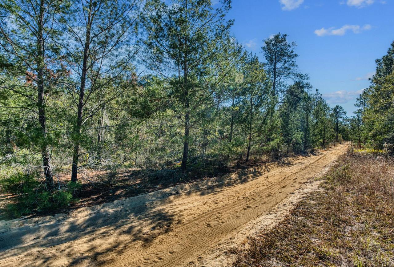
- Physical access. Can you actually drive to the lot today? A road can exist on paper without ever having been built, or it can be a sand track that gets soft after heavy rain.
- Maintenance. Who takes care of the road? Putnam County Public Works says it maintains a significant portion of the county’s dirt and paved roads, including grading dirt roads, and that it handles right-of-way issues. Notice the word “portion.” Not every road is county maintained.
Public Works also inspects driveway permits and site development to make sure they meet county standards, and it posts residential driveway requirements and a right-of-way permit application on its page. If you’ll need a driveway someday, it’s worth reading those requirements before you buy. You can reach Public Works at (386) 329-0346.
The simplest check is free: visit the lot using the GPS coordinates on our listing pages, ideally after a rain.
Step 4: Look at the flood zone and screen for wetlands, and know the limits of the maps
Flood zones and wetlands are related, but they aren’t the same thing. They come from different sources, and neither online map gives you a final legal answer.
Flood zones. The FEMA Flood Map Service Center is the official public source for flood hazard maps used by the National Flood Insurance Program. You can search by address or coordinates. FEMA also notes that its maps are updated over time and that a map you download today can later be replaced. A flood zone can affect where and how you build, and whether a lender requires flood insurance down the road. The county’s own Zoning page links to FEMA’s maps, and the Planning & Zoning page also offers comprehensive plan maps of floodplains and wetland cover.
Wetlands. For a first screening, the U.S. Fish & Wildlife Service Wetlands Mapper is free and easy to use. But the Fish & Wildlife Service is clear about what it isn’t. The map uses a biological definition of wetlands and shouldn’t be read as showing whether wetlands covered by federal, state or local law are present, absent, or how far they extend. If your plans could affect wetlands or other waters, the Service recommends contacting the local office of the U.S. Army Corps of Engineers.
In Florida, state environmental permitting can also come into play. The county’s Zoning page links to the Florida Department of Environmental Protection, the St. Johns River Water Management District and the U.S. Army Corps of Engineers for exactly this reason.
What this means for you. A clean result on both maps is a good sign, but it isn’t a guarantee. A lot that shows some wetland or flood area isn’t automatically a lost cause either. What matters is where those areas fall compared to where you’d build, and whether a professional or the agencies above confirm it. Many listings, ours included, state a flood zone and wetland status right on the page. Use that as a starting point, then look the parcel up yourself. If you’re holding land for a future build, wetlands are the issue most likely to get in the way, so give this step the most attention.
Step 5: Well and septic
Most rural lots in Putnam County don’t have city water or sewer, so plan on a private well and a septic system.
Septic. The Florida Department of Health in Putnam County explains that the Florida Department of Environmental Protection took over the state’s septic rules in 2021, but county health department offices still handle septic permitting and inspections. In other words, your septic permit application goes to the local health department office. Its Environmental Public Health line is listed as (386) 326-3200.
Wells. The Florida Department of Health says well construction is usually overseen by the water management districts, and that some districts have handed that permitting to county health departments. Putnam is on its list of counties where the health department does well permitting. The St. Johns River Water Management District says a permit is required before a new well is installed, and it lists Putnam among the counties with a delegation agreement.
Will both fit on a small lot? This is a fair concern on lots around a quarter acre. Wells and septic systems have to be certain distances from each other, from property lines and from water, and the soil has to work for a drainfield. The health department, or a septic contractor who works with it, can tell you what your specific lot needs. A soil test (often called a perc test) is part of that process. We don’t provide surveys or perc tests on our properties, so you’d arrange that yourself when you’re ready.
Step 6: Know the costs beyond the purchase price
The price of the lot is only the first number. Here are the others.
Annual property taxes. Taxes on vacant rural lots are usually modest, but they vary by parcel. You can look up a parcel’s assessed value on the Property Appraiser site, and past bills, including any non-ad valorem charges, on the Putnam County Tax Collector’s site. If you buy from us with owner financing, the annual taxes are split into your monthly payment and we make sure the bill is paid. If you’re budgeting on a fixed income, write these numbers down before you commit so nothing on a future bill catches you off guard.
Special assessments (MSBUs). The Property Appraiser explains that Municipal Service Benefit Units, also called special assessments, are a way for the county commission to bill the owners who benefit from a specific project. The page says the county has approved 28 separate MSBU projects for road maintenance or paving. These charges show up on the tax bill. Questions about them go to the Board office at (386) 329-0205, not the Property Appraiser. If a lot sits on a road with an MSBU, check the bill so it doesn’t surprise you.
Impact fees. This one is new, and it matters if you plan to build. The county’s impact fee notice says impact fees took effect countywide on June 10, 2025. Impact fees are generally charged when you build, not when you buy the land, but they belong in your budget. Some older listings and articles still say Putnam County has no impact fees. That stopped being true in 2025. The current ordinance and fee schedule are linked from the notice, and Development Services can answer questions at (386) 329-0307.
Step 7: Survey vs. the county map
It’s easy to pull up a parcel on a county map and assume the lines are your boundaries. They’re close, but they aren’t exact. The Putnam County GIS page says its map data is a generalized representation that can change, that it’s meant only as a visual guide, and that it shouldn’t be used as an official description of legal boundaries.
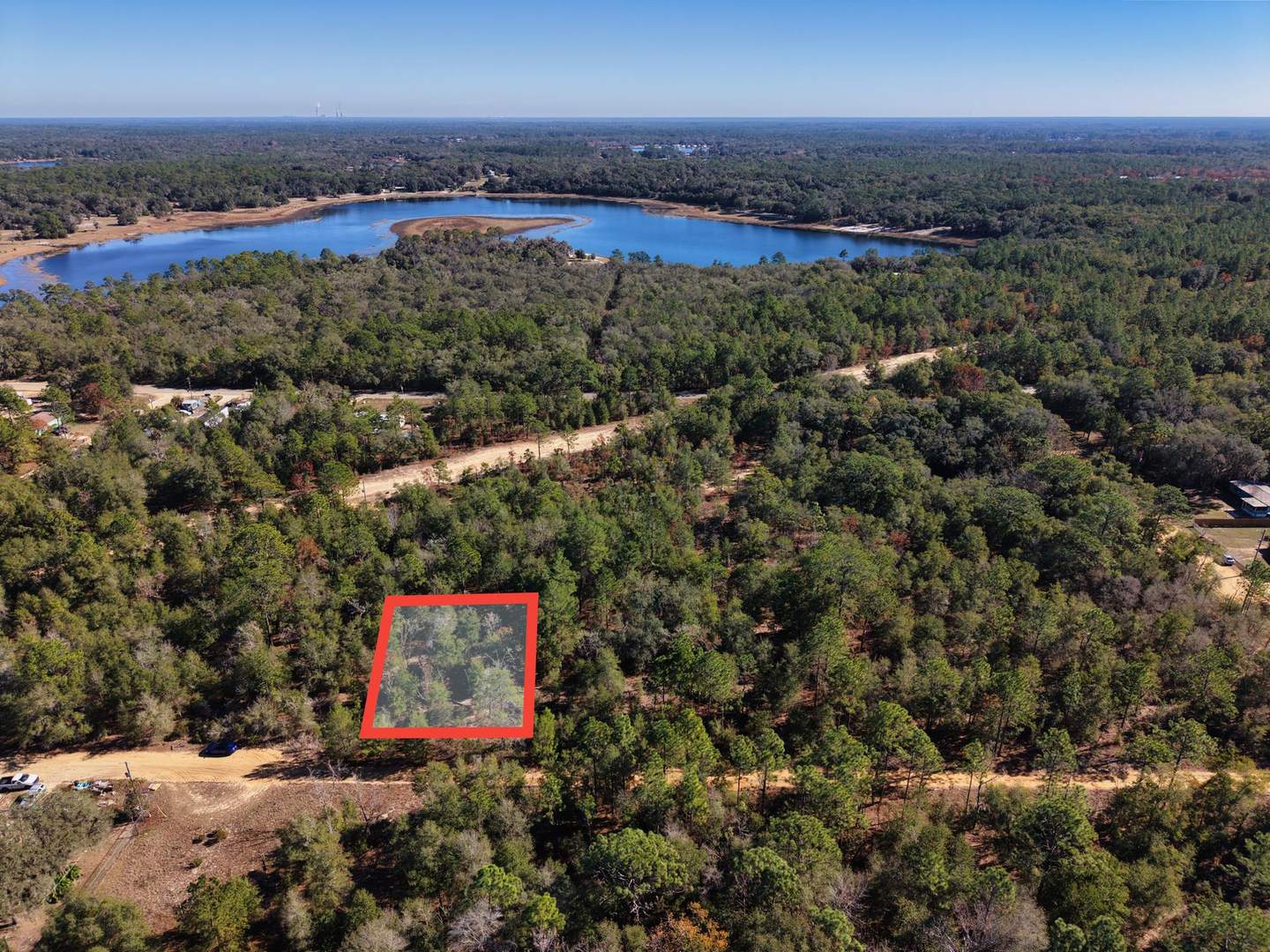
For deciding whether a lot is worth a closer look, the GIS map and the GPS coordinates on a listing are fine. A licensed surveyor is the right call when exact lines matter: before you fence, clear near a boundary, place a home close to a setback line, or settle a question with a neighbor. As I mentioned above, surveys are the buyer’s responsibility on our properties.
A note for campers
If you were hoping to camp on your lot on weekends, I want to be clear up front: camping is not allowed in Putnam County. I confirmed this with Putnam County in October 2026. That includes camping in an RV, so please don’t plan a trip around staying on the land. You’re still welcome to visit and enjoy your property, and if you want to live on it someday, the steps above walk through what it takes to build. If camping is the main reason you’re buying, a Putnam County lot probably isn’t the right fit, and I’d rather tell you that now.
How buying from Vibrant Vistas works
I want to be upfront about how our process fits with everything above.
- No bank and no credit check. You buy directly from us under a land contract with 0% owner financing. Each property page shows the down payment, monthly payment and term. There’s a $249 document fee, and a $10 monthly note processing fee is included in your payment. You can read the details on our How Owner Financing Works page.
- What you can do while you’re paying. You can visit and use the property, and make minor improvements like a pad, a fence or clearing trees.
- What waits until it’s paid off. Living on the property, building a permanent structure, and anything that needs a county permit, like septic or utility hookups. Once you’ve made the final payment, we record the deed in your name and send you the recorded copy. From then on, you can pull permits and do anything the county allows. If you need to live on the land right away, owner financing may not be the best fit, and I’d rather tell you that now.
- 90-day money-back guarantee. Every owner-financed purchase includes one. If, within 90 days of signing the land contract, you decide the property isn’t right for you, we’ll either trade it for one that fits better or give you a full refund, minus the document fee. That gives you time to do the checks in this guide with less pressure.
- Verify us too. We’re happy to send a copy of the recorded deed showing we own the property, and you can find more ways to check us out on our FAQ page and About page.
Ready to look at land?
If you’re still researching, start with the steps above and the county links in each section. If you’ve found one of our lots and want to know whether it fits your plans, send me the parcel number and tell me what you’d like to do with it. I’ll share everything I know about that parcel, point you to the right office, and tell you plainly if I think it isn’t a good fit. If I don’t know an answer, I’ll tell you that and help you find out.
Call me at (435) 246-1224 or email eric@vvlands.com.
Eric Tanner
Vibrant Vistas
Sources
- Planning & Zoning, Putnam County, FL: https://www.putnam-fl.gov/departments/development-services/planning-and-zoning/
- Zoning (resource links), Putnam County, FL: https://www.putnam-fl.gov/departments/development-services/planning-and-zoning/zoning/
- Code of Ordinances, Sec. 45-501 / Table 7.02A Dimensional Requirements, Putnam County, FL (Municode): https://library.municode.com/fl/putnam_county/codes/code_of_ordinances?nodeId=COOR_CH45LADECO_ARTVIIDEDEIMST_DIV2DIRE_S45-501GE
- Impact Fee Notice (DevelopmentFees), Putnam County, FL: https://www.putnam-fl.gov/tag/developmentfees/
- Public Works, Putnam County, FL: https://www.putnam-fl.gov/departments/public-works-services/public-works/
- GIS Interactive Mapping (disclaimer), Putnam County, FL: https://www.putnam-fl.gov/departments/administrative-services/information-technology/geographic-information-services/gis-interactive-mapping/
- Property Appraiser, Putnam County, FL: https://pa.putnam-fl.com/
- Non-Ad Valorem (MSBUs and special assessments), Putnam County Property Appraiser: https://pa.putnam-fl.com/non-ad-valorem
- Putnam County Tax Collector: https://putnamtax.com/
- Onsite Sewage Disposal, Florida Department of Health in Putnam County: https://putnam.floridahealth.gov/programs-services/environmental-public-health/onsite-sewage-disposal/
- Well Construction in Florida, Florida Department of Health: https://www.floridahealth.gov/community-environmental-public-health/environmental-public-health/water-quality/drinking-water/well-construction-in-florida/
- Water Well Construction Permits, St. Johns River Water Management District: https://www.sjrwmd.com/permitting/well-construction/
- FEMA Flood Map Service Center: https://msc.fema.gov/portal/home
- Wetlands Mapper, U.S. Fish & Wildlife Service: https://www.fws.gov/program/national-wetlands-inventory/wetlands-mapper
- Florida Department of Environmental Protection: https://floridadep.gov/
- St. Johns River Water Management District: https://www.sjrwmd.com/
- U.S. Army Corps of Engineers: https://www.usace.army.mil/
This guide is general information, not legal advice. Rules change; confirm everything for your parcel with the offices linked above. Privacy Policy · Terms